Drone Investigations
The LGA Institute for Environmental Management GmbH possesses a DJI Phantom 4 Pro+ drone to record 4K resolution videos or 4K panorama images.
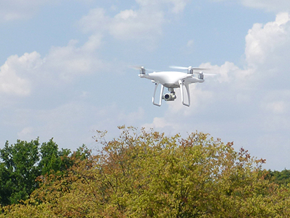
Type DJI Phantom 4 drone in use
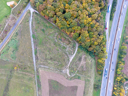
Aerial photograph for the documentation of an area
With the aid of appropriate software, it is possible to create highly precise terrain models, aerial photographs and panorama images. Furthermore current volumes (e.g., of excavated material, surface mining) can be calculated.
With the aid of appropriate software, it is possible to create highly precise terrain models, aerial photographs and panorama images. Furthermore current volumes (e.g., of excavated material, surface mining) can be calculated.
Current images provide considerable advantages, for example, in the evaluation of backfilling or surface mining sites as well as contaminated sites. They enable the identification of hitherto unknown objects on a plot of land.
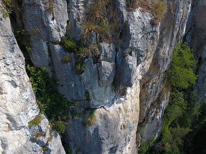
Inspection of rock formations
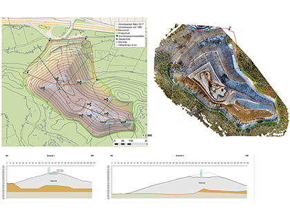
Terrain modelling based on data of drone flights
The interaction of current images and volume models offers a new dimension for the documentation and evaluation of real estate and land. More precise assessment analyses are possible if they are used in combination with further geodata, e.g., geological maps, digital cadastral maps, etc.
We offer you:
- the creation of current orthophotos with a very high ground resolution of up to 5 cm
- images of objects that normally require an extremely high effort to access (e.g., rock walls, roofs, chimneys)
- video recordings of inaccessible areas
- construction site supervision
- volumetric evaluation (e.g., of heaps of excavated material) using software
Download our flyer “aerial photography & surveys”.

Thomas Struller
Expert §18 BBodschG
(SG1 + SG2)
Diplom Geologist
Phone: +49 911 12076 111
Telefax: +49 911 12076 110
Mobile: +49 170 33 20 494
Thomas.Struller@LGA-geo.de

Matthias Linzer
Environmental Protection Engineer
Phone: +49 911 12076 120
Telefax: +49 911 12076 110
Mobile: +49 170 56 50 627
Matthias.Linzer@LGA-geo.de
LGA Institut für Umweltgeologie und Altlasten GmbH
Christian-Hessel-Str. 1
D-90427 Nürnberg
Phone: +49 911 12076 100
Telefax: +49 911 12076 110
info@LGA-geo.de
bewerbung@LGA-geo.de
News

Expertise according to DGUV 312-906
“Every year again...” - The expert inspection and...

Recognition as a body for radon measurements in workplaces
Recognition as a body for radon measurements in workplaces...

Experts for safety structures against alpine natural hazards
Experts for safety structures against alpine natural...

Membership in the RAL Quality Association
Membership in the RAL Quality Association...

Impulse Online Edition
LGA Impulse - Online Edition With the current summer...
Older articles
