Runoff modeling – Valuable forecasting tool for upcoming heavy rainfall events
Posted on 12 June.
Repeated heavy precipitation in 2017 and 2019 led to debris flows in the community of Kauerndorf, which buried the B289 federal road. As a precautionary measure to prevent further debris flows, the construction of an erosion protection construction was therefore planned, which should reduce the catchment area of future heavy precipitation. We were commissioned to prognostically verify the effectiveness of the planned structure. For this purpose, runoff modeling was generated based on the Digital Elevation Model (DTM) with 1-m resolution.
In concrete terms, when calculating a runoff model, sinks without runoff are first eliminated in the DTM (= filled). These are flowed through in reality and would distort the model without correction (= filling). Then, the flow direction of each cell, or square meter, is determined based on the slope. In this way, it is determined into which neighboring cell a drop of water theoretically flows in the cell under consideration. Based on the flow direction, the runoff per cell is finally accumulated. Cells with a high runoff accumulation value are areas where surface runoff is concentrated.
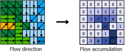
Flow direction and number of cells flowing into each cell
(Source: https://desktop.arcgis.com/de/arcmap/latest/tools/spatial-analyst-toolbox/how-flow-accumulation-works.htm)
In order to verify the effectiveness of the planned erosion protection construction, project manager Thomas Struller set up an investigation concept in which, in a first step, the real runoff conditions are modeled and validated or calibrated on the basis of terrain surveys. In a second step, the terrain surface is manipulated in the model to represent the geometry of the planned construction. Remodeling the runoff conditions with the manipulated surface then shows the runoff after the construction has been built. The difference between the two models can be used to derive the effectiveness of the construction.
According to Simon Landgraf, who performed the modeling and terrain survey, there was no need to calibrate the model. Already the first calculation presented runoff lines that exactly matched the reports of local residents and the event sketches of the debris flows. This high level of agreement is consistent with experience from other projects, in which torrents and mudslides that had already occurred could be reconstructed with meter accuracy by the runoff modeling and thus the source or cause of the event could be determined retrospectively.
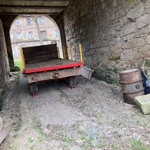
Flown through passage
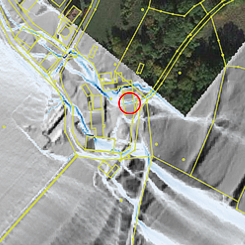
Modeled surface runoff
The second model with incorporated erosion protection construction clearly showed that the runoff formation in the upper slope can be reduced by the construction. There is hardly any surface runoff in this area, which in turn greatly relieves the erosion channel in the lower slope. The effectiveness of the erosion protection construction could thus be prognostically tested and proven.
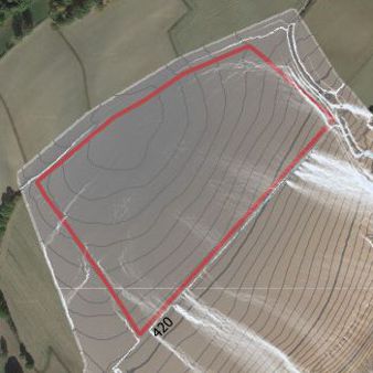
Result of runoff modeling without erosion protection construction
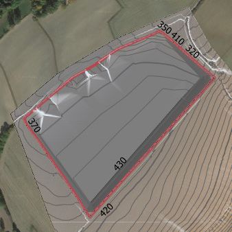
Result of runoff modeling with erosion protection construction
LGA Institut für Umweltgeologie und Altlasten GmbH
Christian-Hessel-Str. 1
D-90427 Nürnberg
Phone: +49 911 12076 100
Telefax: +49 911 12076 110
info@LGA-geo.de
bewerbung@LGA-geo.de
News

Certified pedological construction support
Certified pedological construction support Posted on 05...

Expertise according to DGUV 312-906
“Every year again...” - The expert inspection and...

Recognition as a body for radon measurements in workplaces
Recognition as a body for radon measurements in workplaces...

Experts for safety structures against alpine natural hazards
Experts for safety structures against alpine natural...

Membership in the RAL Quality Association
Membership in the RAL Quality Association...
Older articles
