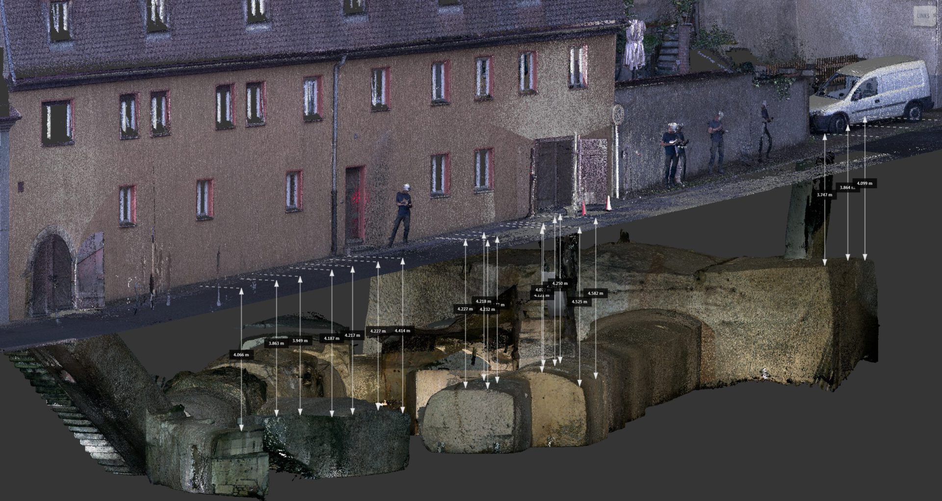
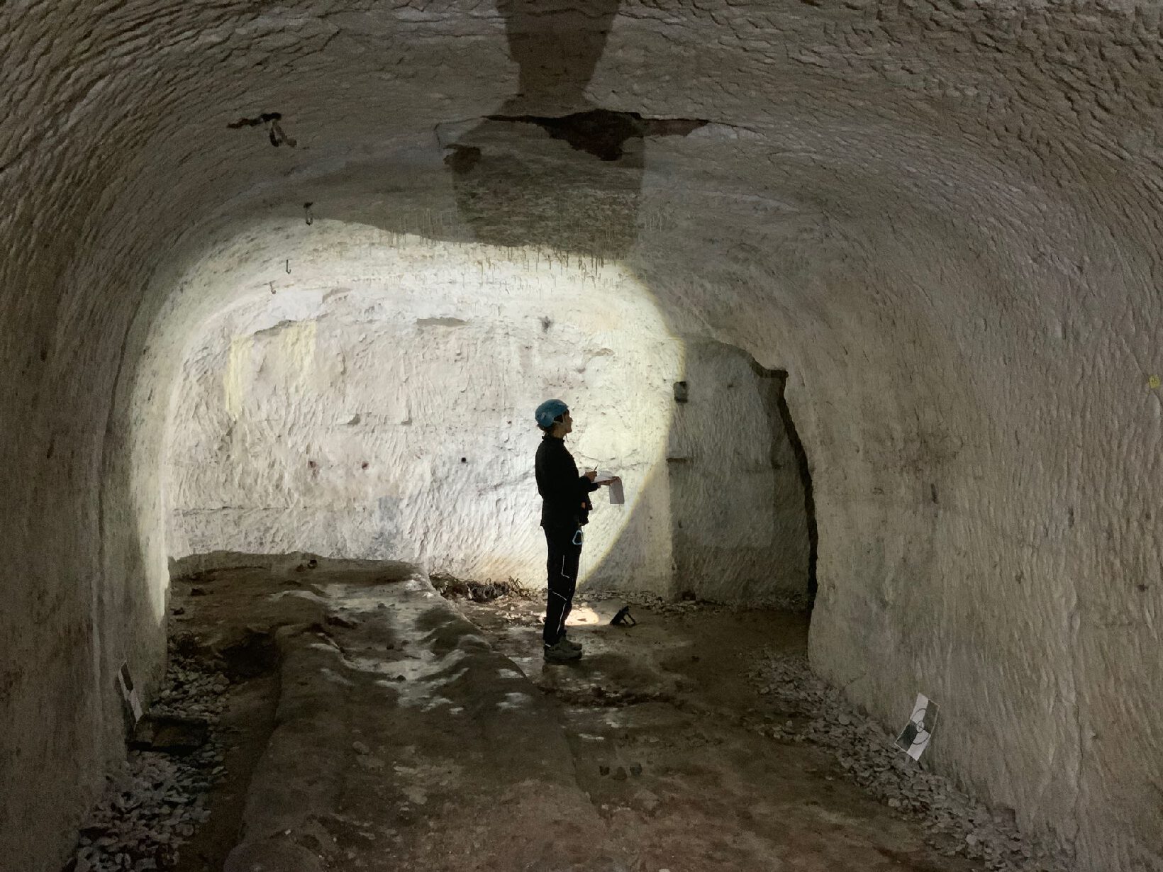
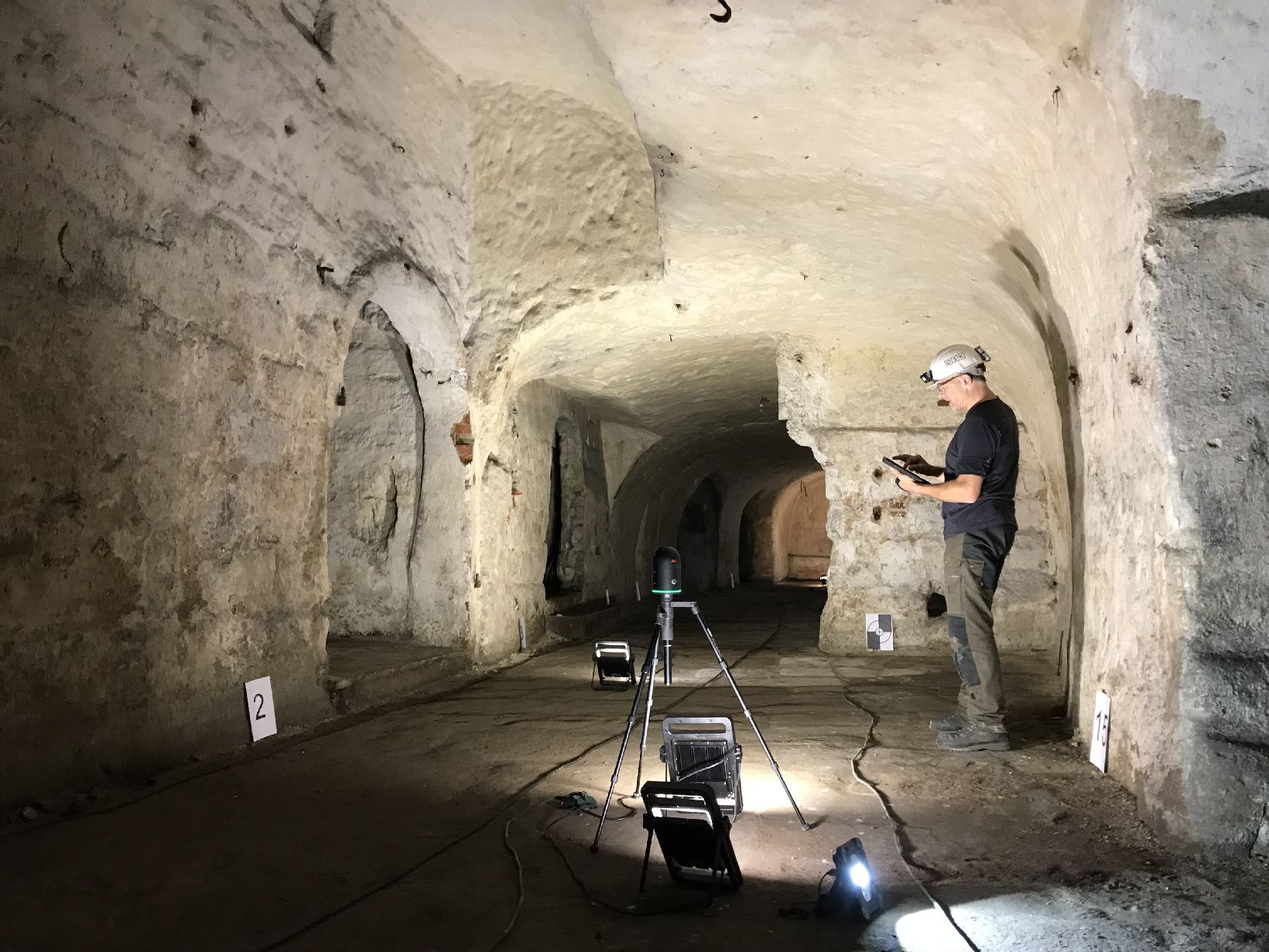
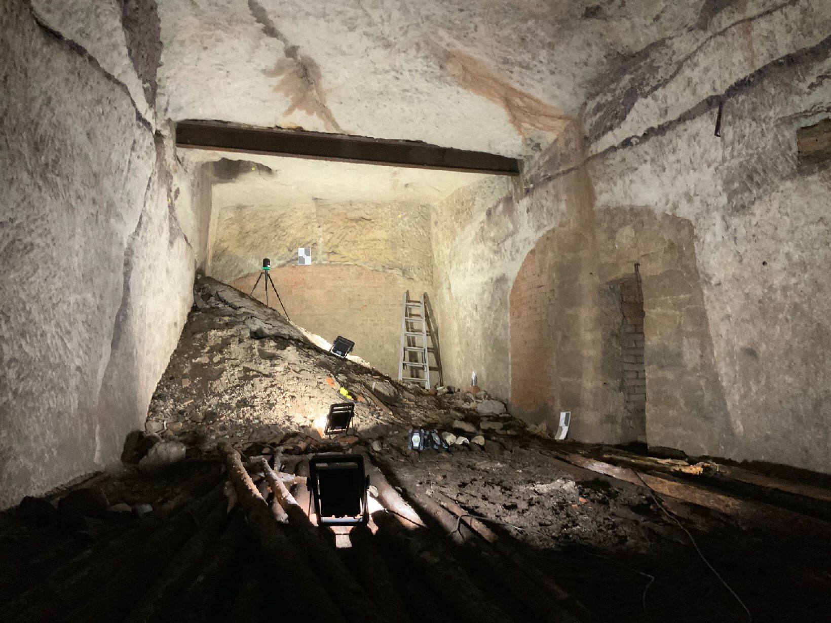
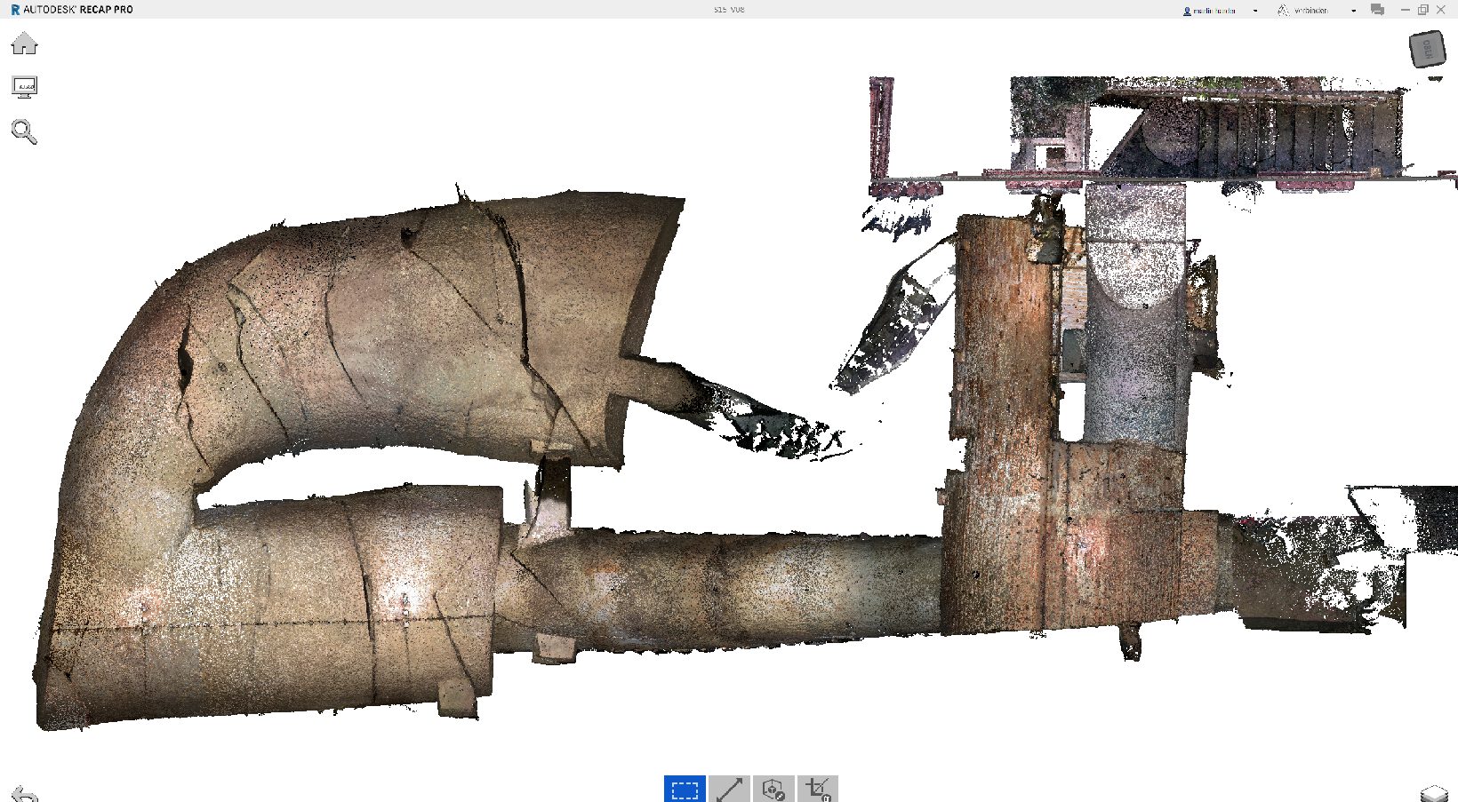
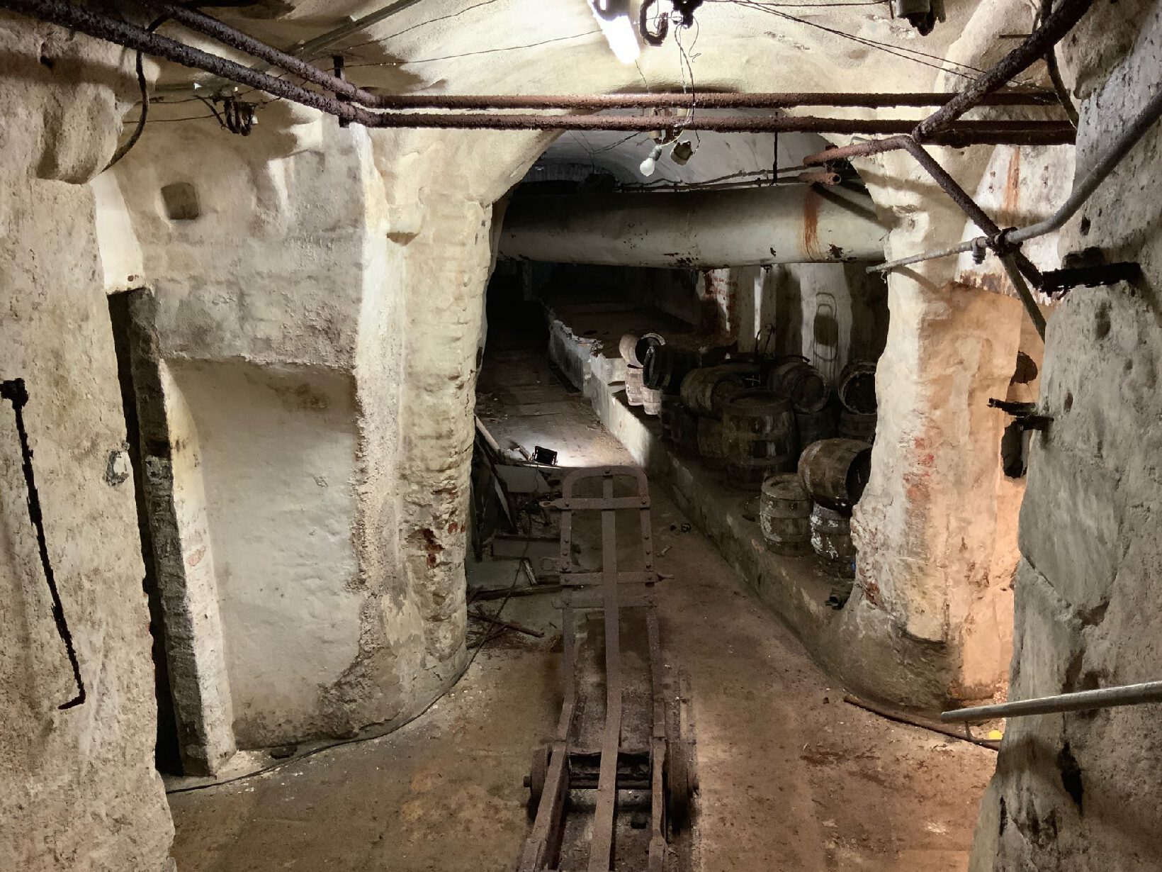
Little was known about the condition, coverage and exact location of a system of catacombs in the city centre, consisting of 26 historic sandstone cellars. The aim was to map the cellar compartments and assess their stability below the public thoroughfares. If necessary, safety measures were planned.
Services
- 3D laser scan survey of streets and basements accurate to the centimetre
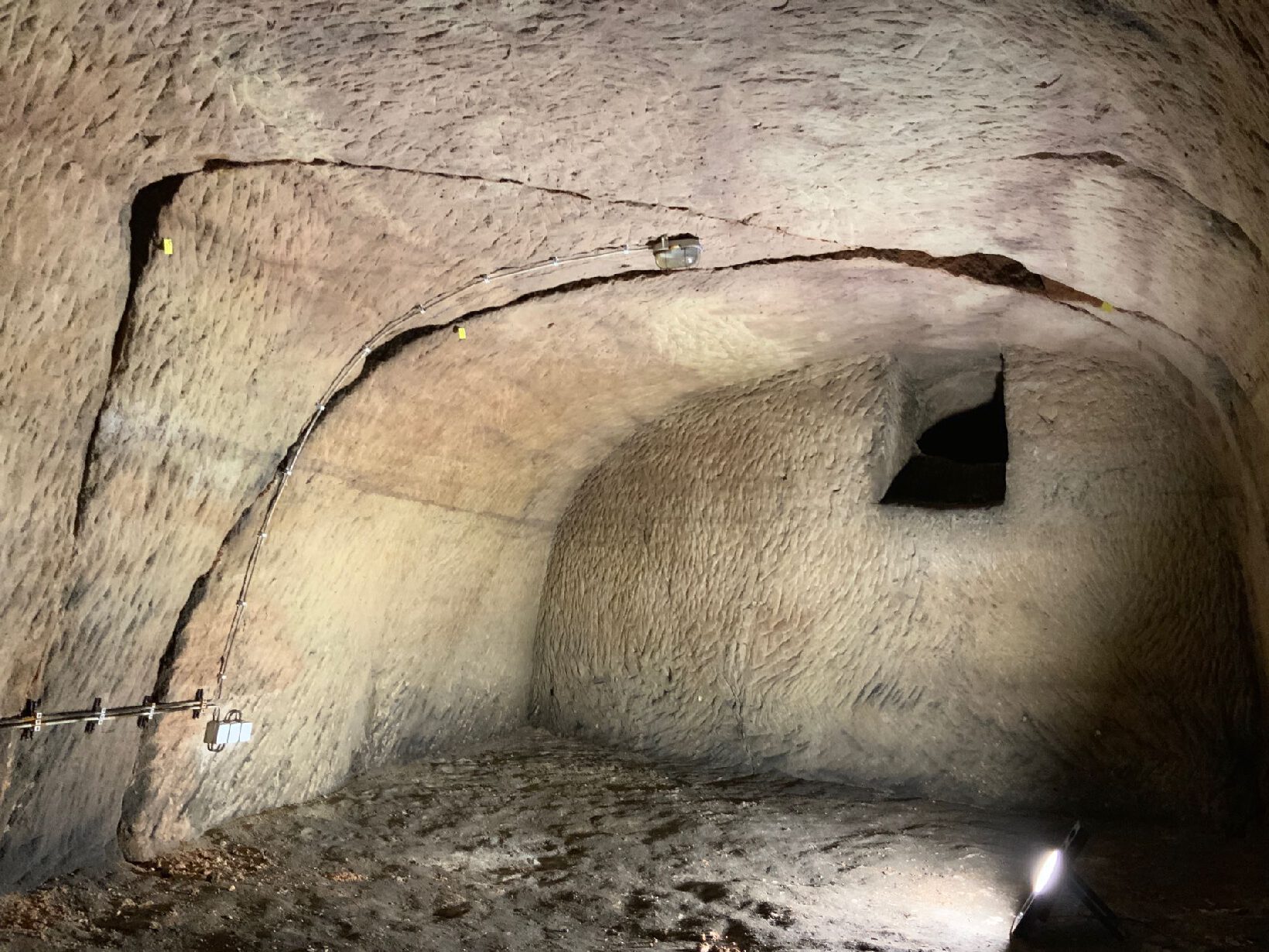
- Detailed geological investigation, in particular mapping of relevant separation areas in the cellars
- Photo documentation and localisation of stability-relevant features in the 3D survey data
- Creation of 3D models of the vaulted cellars and georeferenced overview and detailed location plans in GIS
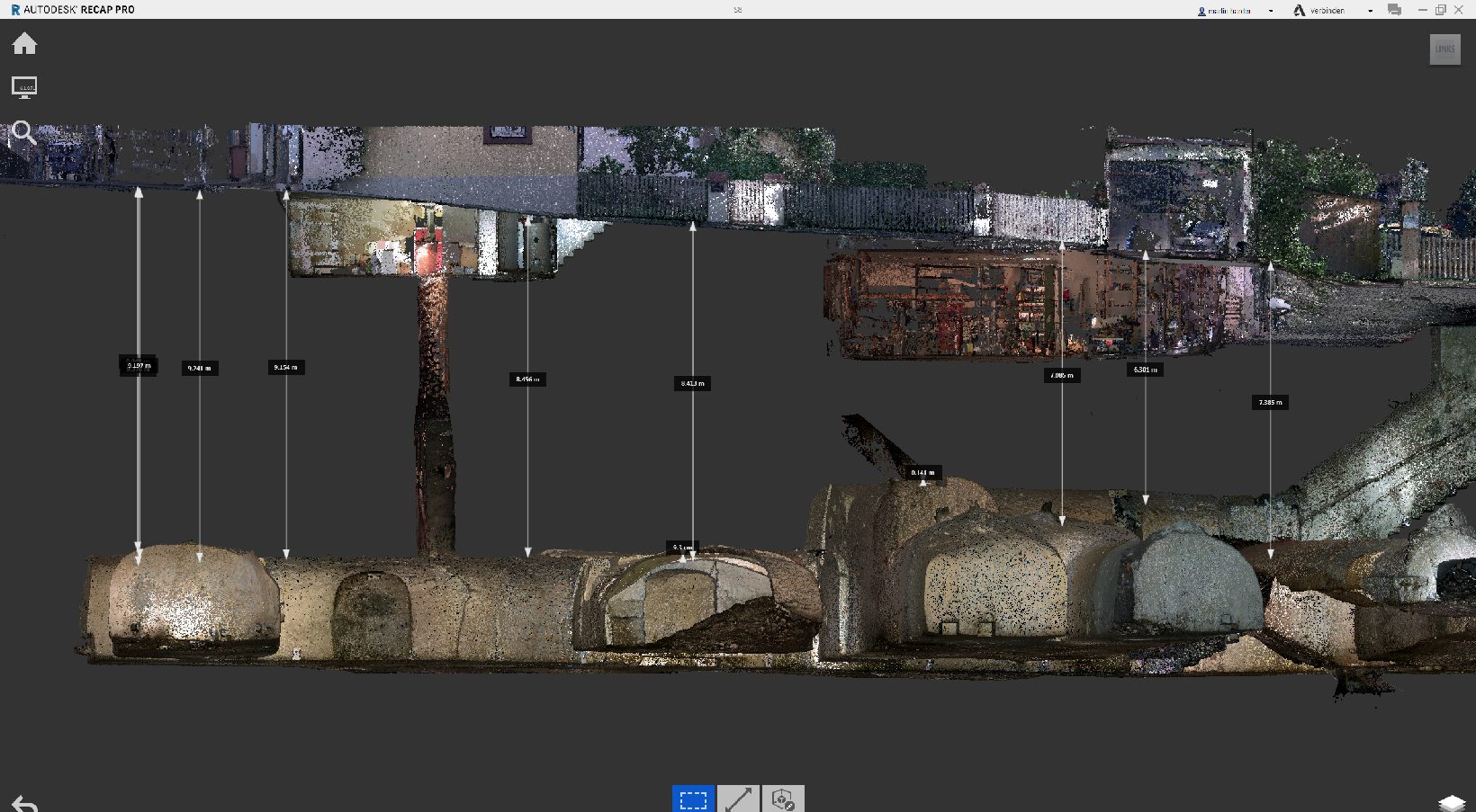
- Creation of scaled longitudinal and cross sections of the basement systems including ground surface and dimensioning of the covering
- Carrying out heavy dynamic probing and exploratory drilling to assess the surface layers
- Stability analysis taking into account the geological features, the vault geometry, the cover and the position of the sewer in the road
- Development of security measures