Das Bild zeigt ein grafisches Unternehmenslogo in Blau- und Grüntönen mit einer stilisierten Wellenform. Rechts daneben befinden sich die drei Großbuchstaben LGA, gefolgt von eine kreisförmigen grafischen Fläche als Gestaltungselement.
LGA ' company ' news ' Drone flight in the beer cellar – inspection and surveying, this time partly remote

Drone flight in the beer cellar – inspection and surveying, this time partly remote

Eine kugelförmig geschützte Drohne liegt auf einem rauen Betonboden in einem Keller. Die Drohne besitzt vier Propeller und ist für den Einsatz in engen oder industriellen Innenräumen konzipiert. Im Hintergrund stehen orangefarbene Getränkekisten und weitere Gegenstände.

The beer cellars of the Upper Franconian tunnel system were originally intended to be examined using the proven method: an engineering geological assessment of the rock quality combined with a detailed survey of the tunnels and the ground surface to determine the overburden. When these data sets are combined, the stability of the tunnels can be reliably evaluated. But what can be done when the tunnels are not accessible for safety reasons?

Das Bild zeigt einen unterirdischen Gang mit grob behauenen Felswänden und einer unebenen Decke, in der ein großer Riss sichtbar ist. Mehrere Kabel hängen lose von der Decke, und am Boden liegen zahlreiche Gesteinsbrocken. Die Szene ist mit künstlichem Licht ausgeleuchtet, wodurch die Struktur des brüchigen Gesteins deutlich erkennbar ist.
A so-called “coffin lid” refers to a large, flat rock slab that can suddenly detach from the ceiling along existing fractures.

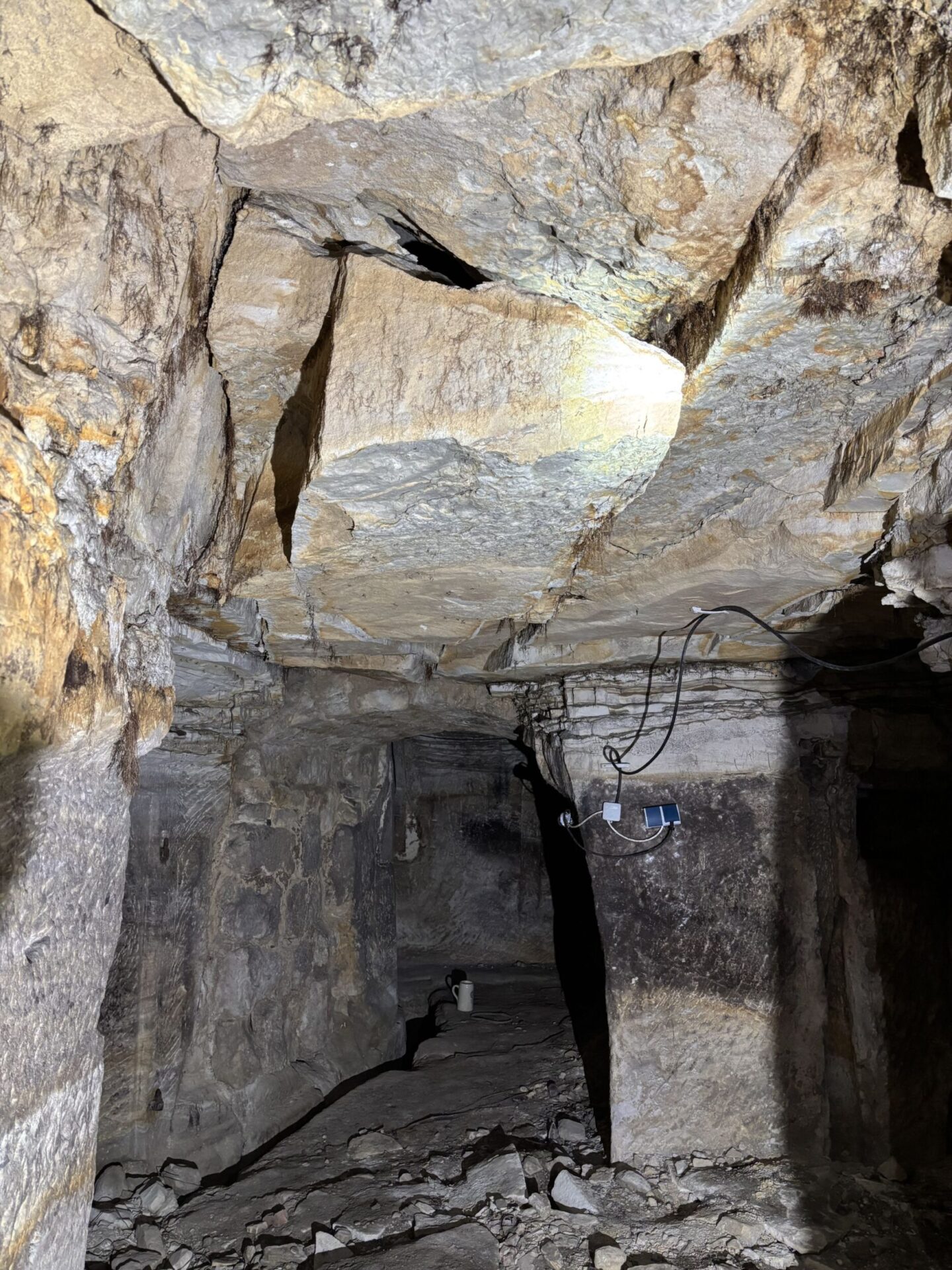
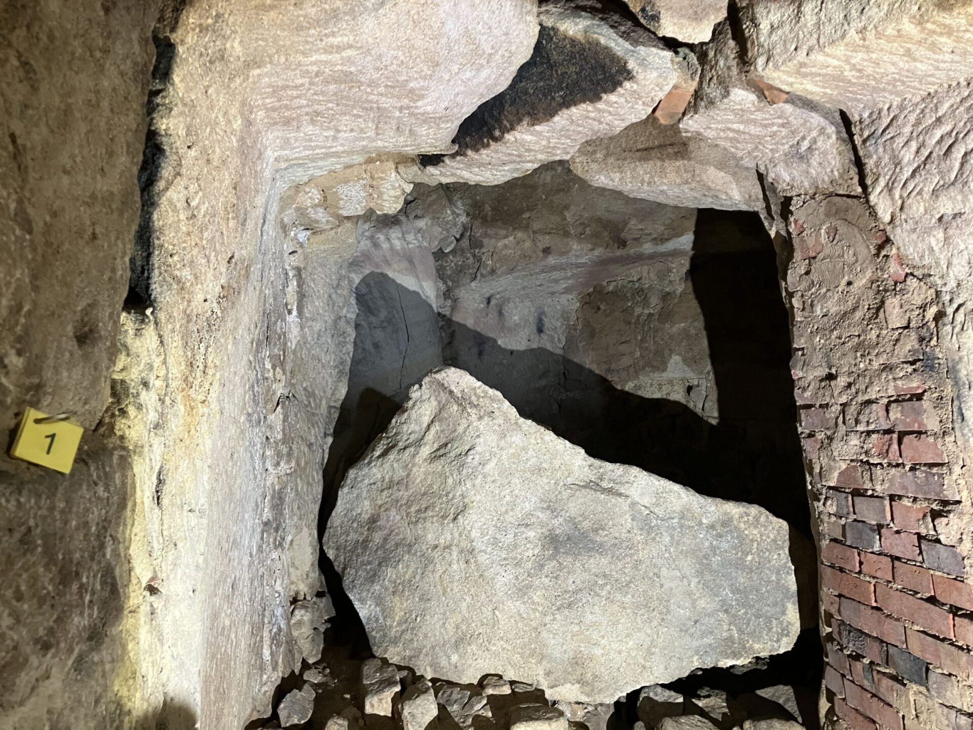
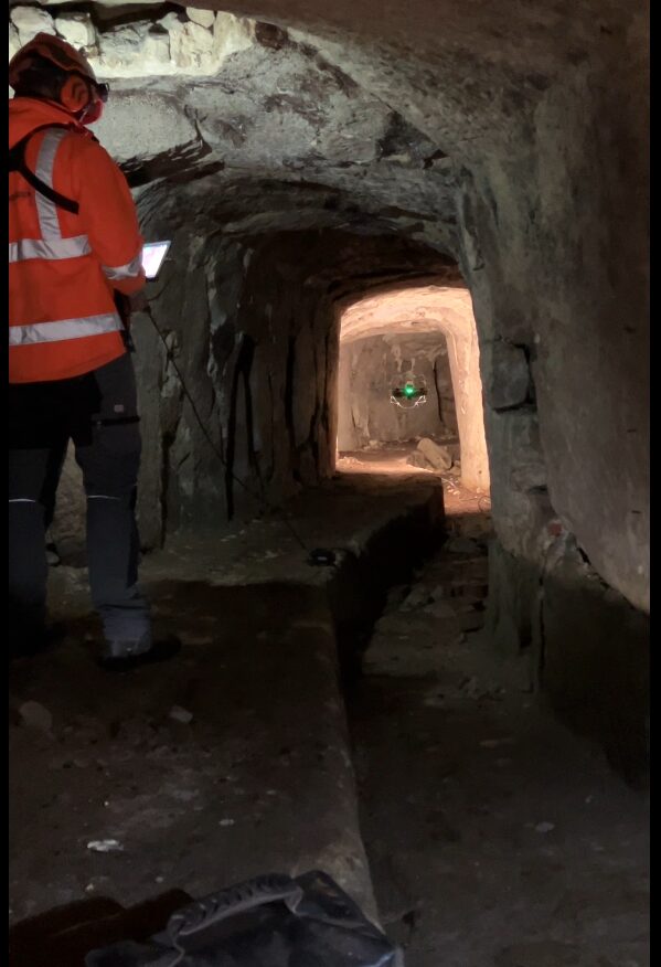
During the initial overview of approximately twenty beer cellars at the start of the project, it quickly became clear that an alternative to the traditional on-foot inspection was necessary. Project manager Joschka Wischer identified several areas in six cellars that could not be safely accessed by geologists or surveyors. Massive fractured blocks hanging from the ceiling and numerous fallen blocks on the floor indicated an acute risk of rockfall and recent collapse activity. A physical inspection and survey of these sections was not feasible, yet they were crucial for assessing structural stability. In other sections, large quantities of bulky stored items made access extremely difficult and would have required significant additional time.

Das Bild zeigt einen unterirdischen Bereich mit grob behauenen Felswänden und einer teilweise gemauerten Wand aus roten Ziegeln. In der Mitte liegt ein großer, abgestürzter Felsblock, umgeben von kleineren Steinen und Geröll. Die Szene ist mit künstlichem Licht ausgeleuchtet, wodurch die Struktur und Bruchkanten des Gesteins deutlich sichtbar sind.
Detached rock block on the cellar floor with an edge length of more than 1 meter.

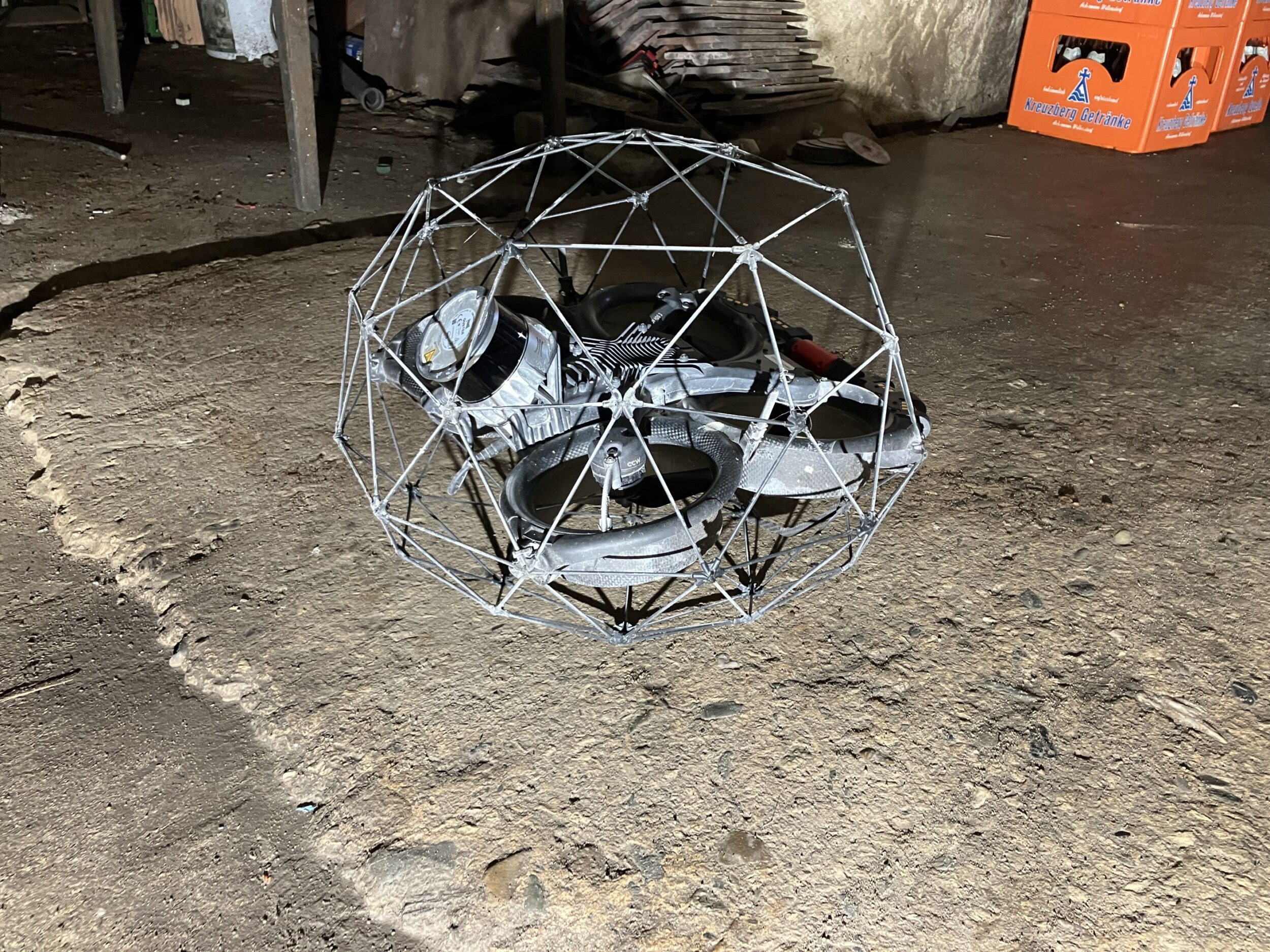
The solution: flying a drone through the hazardous sections. Protected by a cage, the drone captured video and scanned the relevant areas in one to two flights per cellar. Including setup, takedown, and battery changes—each lasting about five minutes—the effort per cellar amounted to roughly half an hour, depending on the size of the restricted zones.

Das Bild zeigt eine Person in einer orangefarbenen Arbeitsjacke, die ein Steuergerät mit großem Bildschirm hält. Auf dem Monitor ist ein Livebild eines Felsenkellers von einer Drohnenkamera zu sehen. Im Hintergrund stehen Getränkekisten und Kunststoffboxen in einem schwach beleuchteten Keller.
View of the drone pilot’s control unit.

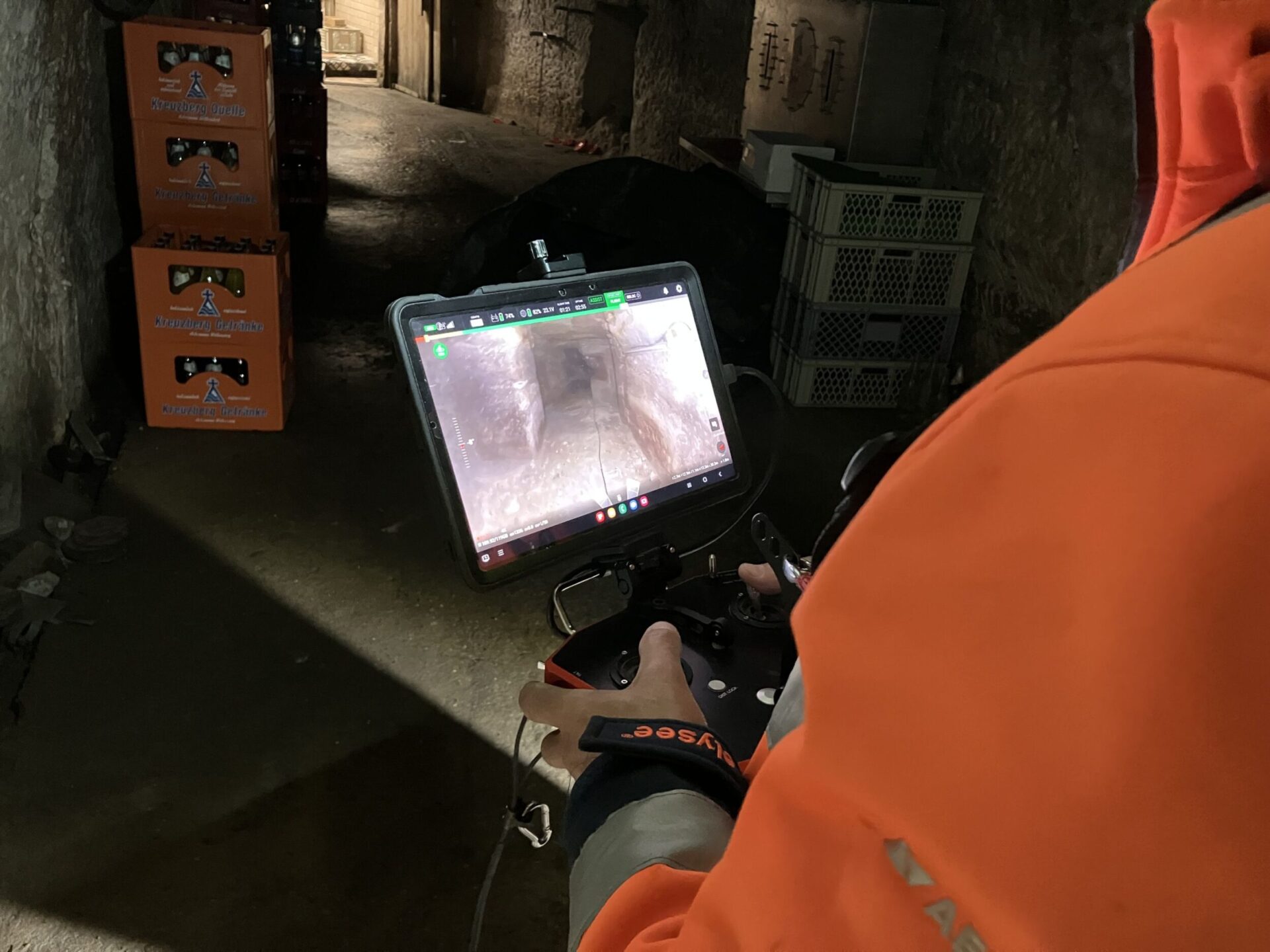
One particular challenge was maintaining the drone’s signal within the underground tunnel system. To improve reception, a wired transmitter was carried as far as possible into the tunnels and, in some cases, pushed through hazardous sections using rods. Every additional meter gained was valuable, as the signal tends to drop when the passages curve too sharply or when the tunnel network branches extensively.

Das Bild zeigt einen schmalen, unterirdischen Gang mit grob behauenen Felswänden und unebenem Boden. Im Vordergrund steht eine Person in orangefarbener Schutzkleidung und Helm, die ein Steuergerät bedient. In der Mitte des Ganges schwebt eine kleine Drohne mit grün leuchtenden Positionslichtern, die für eine Inspektion eingesetzt wird.
The drone, identifiable by its green light, is exploring sections of the cellar that are not accessible on foot.

The result speaks for itself: high-resolution point clouds that accurately represent the tunnel geometry and even reveal fracture planes, along with several hours of video footage that allow mapping of previously inaccessible cellar sections. The pilot project “Drone Survey in Beer Cellars” can be considered a success.

back to overview

Find information about our services, project references, Locations, Job adverts or current articles in our full text search.